Tuesday, June 30, 2009

Soldotna, Alaska

Greetings!


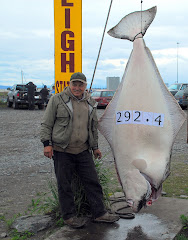
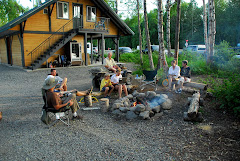
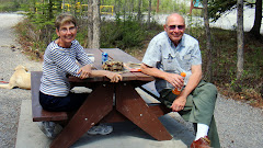
While we were still at Captain Cook State Park, Dorothy and Dave unexpectedly happened to drive by on Sunday afternoon. They then took the space next to ours for the night. Dave brought over some freshly caught salmon and Jerry cooked it on the grill outside. We are eating a lot of salmon!!! And we love it!

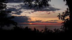
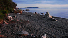
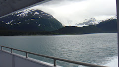
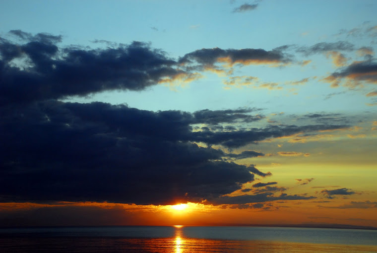
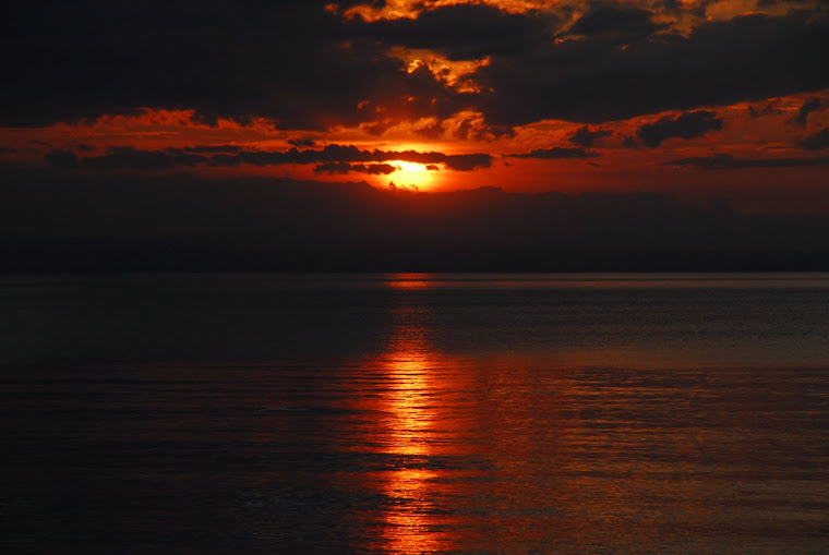
Later that evening, we took a walk to the cliff and took some more pictures of the beautiful sunset. Again, it was 11:20 p.m. when we took these pictures.

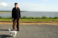
The next day Dorothy and I walked around the park before Dave and Dorothy took off.
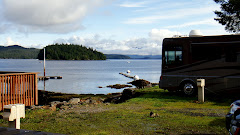
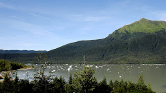
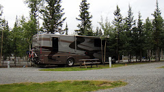
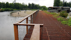
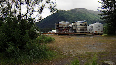
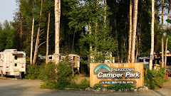
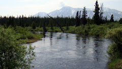
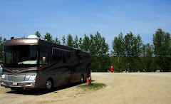
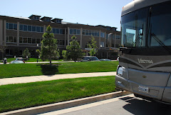
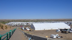
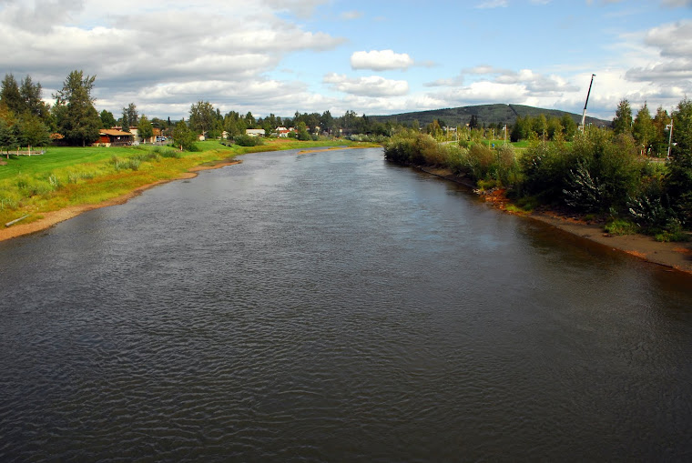
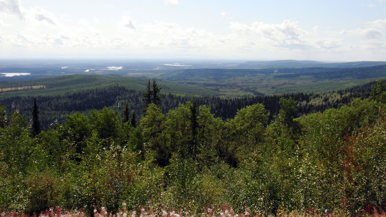
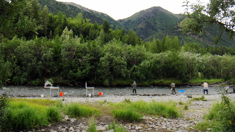
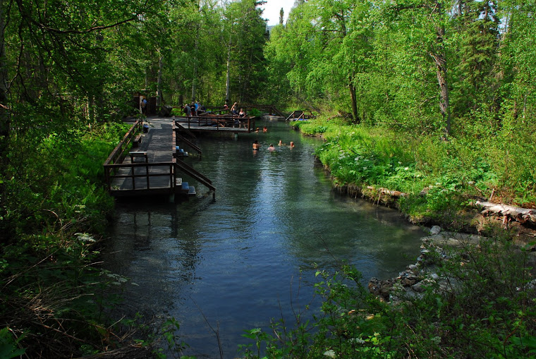
Today (Tuesday), Jerry and I left our peaceful hide-away and moved into the small city of Soldotna, where we will stay for the 4th of July weekend. The RV park is located right on the Kenai River (see picture below) and is within walking and biking distance of downtown. Dave and Dorothy are due to join us on July 3rd.

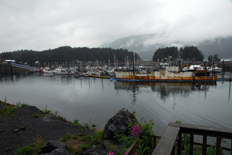
We have really lucked out with the sunny weather on this trip. All the locals that we talk to tell us that this weather is uncommonly sunny for this time of the year. Normally, Alaska experiences a lot of rain. But, we encountered rain only in Seward thus far. Hope it stays that way for the 4th of July.

Until next time, stay safe.

Jerry and Mary

Saturday, June 27, 2009

Captain Cook State Park - Alaska

Well, it really took us 30 minutes instead of 15 minutes to get here today. What a lovely place!. Nestled in trees with campers spaced well apart, situated right on the ocean, and with no one on either side of us, it is almost as if we are here by ourselves.

Saw a bear crossing the road as we drove in here earlier today. The Park Host told us that the mother bear died and her two cubs are roaming the park area -- and they are aggressively trying to get at the people's food. We were advised to be careful.

Jerry is grilling salmon outside (salmon that Dave caught), and we will be eating outside tonight. Later, he will build a fire and make popcorn. Hope the bears stay away! It is sunny and 67 degrees, with very little breeze.
Our internet connection in now via Verizon broadband -- not at all what it was in Kenai.
We plan to stay here until Tuesday. Hope you are all enjoying your weekend.

Jerry and Mary

Friday, June 26, 2009

Kenai, Alaska - Tides and Mount Redoubt

Hello everyone,

Just want all the travelers out there to know that the Beluca Lookout Lodge & RV Park here in Kenai, Alaska has the fastest wi-fi internet speed of any place we have been to since the start of our trip. It's a beautiful park, too, right on the bluff overlooking the water and within walking distance of town's various commercial and eating places. Also, the RV Park has washers and dryers which have a number of boondockers coming here just to do their laundry. Kenai is the largest of the towns on the Kenai Peninsula and has 7,100 people. For those that need supplies, it also has a Home Depot, Lowes, and a Walmart under construction.

From our RV window, we can watch the tides come in and go out. The incoming water rushes in so fast, it is amazing to watch the bay fill up. The literature states that the "37-foot tides here are exceeded only by those in Nova Scotia's Bay of Fundy." See picture of the high tide above and picture of low tide below it.

Today, we took a nice 3-hour bike trip around the town. The city of Kenai has a great bike path running along the Kenai Spur Highway.

As an added benefit - we can see Mount Redoubt also from our RV window and watch the steam coming off of the mountain. See picture below.

Tomorrow (Saturday), we will pack up and travel a short distance to the Captain Cook State Park. It will probably take us a whole 15 minutes to get there.

Have a great weekend, everyone.

Jerry and Mary

Wednesday, June 24, 2009

Exit Glacier, Cooper Landing and Kenai, Alaska

Hi again everyone,

We are located at the mouth of the world famous Kenai River in Kenai, Alaska where it meets the ebb and flow of the Cook Inlet tides. Here is where the salmon enter that the people on the Kenai River are trying to catch. Dave and Dorothy left on Monday to get a head start on fishing.
Even though it rained off and on most of our time in Seward, Jerry had to build a fire on the last night we were there. We loved Seward and only wished we could have taken our bikes out on their long bike trail. Who knows, we may just come back to this place.

(We have super fast wi-fi here in Kenai which makes updating this blog fun and easy.)

After we left Seward, we went to see the Exit Glacier. The drive to the Glacier was on 9 miles of paved scenic road. The Glacier itself is 3 miles long. We had to walk 1/2 mile to get there and then could walk down to the "toe" of the Glacier. Unfortunately, they didn't tell us that after we got down to the bottom, we, along with everyone else, had to figure a way to cross the running water from the Glacier. Most people (including us) decided not to try to cross the water streams.


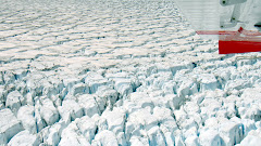
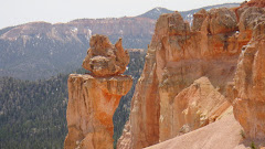
(See more pictures of Exit Glacier on the side and down below.)

After leaving Exit Glacier, we stopped near Cooper Landing. Everywhere we saw a river, we saw people standing in the water trying to snag salmon. We stopped at a beautiful place along the highway and had a great halibut dinner that Jerry made. See picture below of our view.

After dinner, we were driving down the road and saw Dorothy and Dave's RV parked in a rest area beside the road. We made a U-turn and joined them. But, Dave's plan was to move on at 11 pm so that he could fish from 11-2 am (that was suppose to be the best time to catch fish). Sure enough, they were gone this morning. He later left us a voice mail to say that he caught four salmon last night.

We plan to stay here at Kenai for at least three days. The temperature is about 55 degrees with a few clouds. Even though it is now 11:30 pm, it feels like 6 pm as it is that light outside.
We have been staying up quite late because it stays bright outside, even in the middle of the night.

Will probably write more later before we leave here. Have to take advantage of this fast internet.

Take care,

Jerry and Mary

Sunday, June 21, 2009

Beautiful Seward, Alaska

Happy Father's Day to all the fathers, step-fathers and father substitutes out there!

Well -- finally we had the pleasure of eating fresh salmon just caught the same day here in Alaska. Jerry and Dave went fishing at the mouth of a river where the salmon were traveling from the ocean into the river, going upstream to spawn. Dave hooked three salmon. And, we had a great salmon feast that night. Just had to tell the world about it!

See video below:


It rained real hard the last two days, and off and on all day today (Monday). The forecast is for three or more days of rain.
We are dry camping and expect to leave Seward on Tuesday. Hate to leave Seward because it really is a beautiful place -- easy to walk the town or the bike path, watch the sea otters floating by on their backs from our window, see the cruise ships come and go, watch the tide levels go up and down, and with binoculars, check out the number of people fishing across the bay (where Jerry and Dave went fishing).

Until next time -- enjoy your life. Jerry and Mary

Thursday, June 18, 2009

Whittier and Seward, Alaska - Kenai Peninsula


Hi Everyone,

We hung around Valdez for four days and really enjoyed this sleepy little town. Not much to do there, but it is beautiful with all the high snow covered mountains surrounding the whole place and its location right on the water. See more pictures below. Jerry washed the RV (a five hour process after all the mud and dirt caked on it from our travels on those rough roads).
On Wednesday (June 17), we had a scheduled appointment to drive the RV onto a Ferry that took us on the marine highway for 2-1/2 hours over to Whittier, Alaska on the Kenai Peninsula. We took the noon Ferry because the only other one leaving Valdez would have taken 5 hours and would have left at 8 in the morning. Taking the Ferry saved us driving approximately 320 miles to get here and traveling back over some of the same roads we were already on.


But, even more so than that, the experience of boating right past ice caps sticking out of the water, seeing a beautiful glacier, watching the lush greenery of the mountains with snow patches and waterfalls, and feeling the speed of the Ferry was exhilarating. Unfortunately, the weather didn't cooperate, but that was minor.


After driving our RV off of the Ferry (with guidance from the crew), we drove through a 6-1/2 mile tunnel (one way traffic only). We were held up, along with all the tour busses and everyone else, because we were told that two motocycles went down in the tunnel.

Dave and Dorothy saved a spot for us at a very nice RV park outside of Whittier, Alaska (yes - Sue and Raul, there is a Whittier, Alaska, too). We spent the evening catching up. This was a great spot for parking the RV and we may come back to it. It is called the Williwaw Park.

On Thursday, we all moved on to Seward, another city surrounded by mountains, and located on Resurrection Bay. We are parked parallel to the water's edge (about 25 feet from the water) and look across the water to the mountains on the other side. We see cruise lines and hugh oil tankers come and go right in front of us. Since we have been here, there have been low hanging clouds in the mountains and an occasional rain.

Dorothy and Dave joined us for dinner and afterwards then we all took a long walk on the paved bike/walkway that runs along the ocean bank. There are numerous RV parks here, one right after the other along the waterway.

Today (June 19), Jerry and Dave left to get a fishing license for Jerry and then try their hand at fishing. Dorothy and I will hang out together for the day.

Sunday, June 14, 2009

Valdez, Alaska

Hi Everyone,

We decided to drive from Tok to Valdez even though it was a longer drive than we had planned for the day. But, the drive was absolutely beautiful. We saw the Worthington Glacier (and "blue ice" that we had never seen before). It was raining off and on, so it was a bit difficult to capture the beauty of this drive on the camera. But, we tried. See slide show below. As great as the scenery is, one has to put up with the rough road, though.


Dorothy and Dave are in Anchorage and we will catch up with them in Seward next weekend.

Jerry and Mary

Friday, June 12, 2009

Tok, Alaska - Mile 1314


WE MADE IT TO ALASKA!

But, first, let us catch you up since the last blog.

After passing through Telsin, and encountering a few slow-downs due to road constructions (mainly on bridges), we wanted to go to Johnson's Crossing (Mile 809) because we read about the good cinnamon rolls and pastries served at the place. It was raining slightly when we arrived. Later that night, we saw a red fox about 15 feet from our RV. Tried to get a picture, but he/she heard us and moved quickly away.


The next morning, we walked over to get a cinnamon roll and a turnover (cherry and blueberry). They were as advertised -- delicious.


Johnson's Crossing is known for the highest bridge on the Alaskan Highway. See picture below.

After leaving Johnson's Crossing, our plan was to spend a couple of days in Whitehorse (Mile 888), the capitol of the Yukon (pop. over 24,000). But, once we arrived, we felt that we were somewhat back in civilization (even had our Starbucks) and decided to move on. But, before we did, Jerry tried to buy some halibut and salmon (obviously, we haven't been fishing for them, yet). He went to three grocery stores. Two had salmon, alright -- Atlantic farm raised salmon. Can you believe it? But, he found Copper River Sockeye salmon and Alaskan halibut at the third place. In a few more weeks, we (I mean Jerry) should be catching our own.


We left Whitehorse after shopping and headed up the road to the Takhini Hot Springs. We had to leave the Alaskan Highway and travel on the Klondike Highway for about 10 miles. After our great experience at the Liard Hot Springs, we were hooked on hot springs. But, what a disappointment the Takhini Hot Springs was! First of all, it was more like a commercialized hot swimming pool. It was not a spring. The water may come from a spring, but they have enclosed it in a large concrete swimming pool with algae on the bottom and dead mosquitoes floating on top of the water. Not only that, along with the fee for camping (which is on the high side), you have to pay to enter the "hot springs." All-in-all, definitely not worth the price. We didn't even bother to take pictures, except for the wonderful RV site surrounded by all trees.

For those of you who are specifically following Dorothy and David's adventure, we had an opportunity to talk to them the other night by cell phone. They made it through to Liard Hot Springs prior to the Highway being closed down. They are in Valdez where Dave is trying to catch fish.

On Thursday (June 11), we spent most of the day traveling the Alaskan Highway, making 280 miles in 7 hours. This was one of our longest drives, and we expect to slow up from here going forward. Everything we have read and heard prior to making this trip was that, between the Haines Junction turnoff and Beaver Creek (just before the Alaskan border), the road would be under major construction and is some of the worst part of the Alaskan Highway. Well -- it lived up to its reputation! Between pot holes, gravel roads in the process of being resurfaced, dirt and dust for miles, and road heaves (dips in the road), it was quite a bumpy ride. When trucks pass you coming or going, they kick up a real dust storm on the gravel roads -- and they throw rocks. Yes, our windshield has already been hit. Replacing the front RV window after an Alaskan Highway trip is a given and should be factored into the cost of trip.

Last night we stayed in Beaver Creek in the Yukon (Mile 1,168). It is just a few miles from the Yukon-Alaskan border. It rained most of the night and this morning.
Then, today (June 12), we crossed into Alaska, and, of course, had to have our picture taken by the welcome sign. See it below. We are staying at the Sourdough RV Park in Tok, Alaska. They are known for their sourdough pancakes and reindeer sausage. Earlier this evening, they had their daily "pancake throw." The key was to throw a left-over pancake and get it into the bucket about 24 feet away. Only four out of 35 people were able to do it -- Jerry being one of them. For that, he gets his breakfast free tomorrow. Looking forward to having the fresh sourdough pancakes and reindeer sausage in the morning before we leave, heading towards Valdez.


So far, we've traveled 5,300 miles on this trip, partly because we went south before going north to Alaska. Now that we are here, we will be taking our time trying to experience as much as we can of this beautiful state.
Until next time -- Jerry and Mary

Monday, June 8, 2009

Watson Lake, Yukon Territory - Mile 613

Hi Everyone Again,

Trying to catch up, with internet connections slower than dial up, is a challange. If you didn't have patience when you start writing a blog under these circumstances, you quickly develop it.

Today, we walked over to the Watson Lake Signpost Forest, a block from the RV park. See the picture of the sign below that describes this unique area. Of course, we had to add our sign consisting of a Pines by the Sea license plate cover with our names, date and words from part of an old (embossed) t-shirt from the East West Ranch (now called the Fiscalini Ranch) ("This is Your Land" Cambria, North Coast SWAP California). In 2006, there were 61,398 signs posted in the Signpost Forest. Now there are 61,399 and, obviously, a lot more than that. See the video of us hanging our sign.


Then, this evening, we attended a show at The Northern Lights Centre that included a portion on astronauts and the aurora borealis. Having actually seen the aurora borealis while living in Grand Forks, ND many years ago, I found the scientific explanation comforting. The Centre is a state-of-the art panoramic video and surround sound system inside a special titled dome. The show lasts 55 minutes and is well worth it.
Tomorrow, we move on again up the Alaskan Highway. Every now and then, it feels good to get back into civilization. But, we are more than ready to move on out again. Never know what we will experience next!
Jerry and Mary

Sunday, June 7, 2009

Muncho Lake and Hot Springs, British Columbia


Whew! What a week! It's times like these that we are so thankful to be able to live our lives without any timeline.


Dorothy and Dave left us on Tuesday (June 2) to move on to Muncho Lake. Driving to Muncho Lake and surrounding the Lake are snow capped mountains. There are only 15 sites in this particular Provincial Park and they were all filled. But, they were able to secure two sites for us early the next morning. And what beautiful sites they were -- right on the lake as you can see in the pictures! In the five days that we spent there, it was amazing to see the number of RVers showing up after 5 p.m. each day expecting to find a site at this small park.

The one thing you first notice about this beautiful 7-mile long lake is how blue-green is the water. This is because sulfur leaks into the water, turning it a stunning blue-green color. The air temperature was in the low 80s and it was great. The slide show shows a little about our stay in this beautiful place.


On Thursday (June 4), Dorothy and Dave left because Dave was anxious to get to Alaska to start fishing. We stayed on because it was so beautiful.
On Thursday afternoon the Park Ranger came through and told everyone that the Alaskan Highway was closed about 60 miles up the way due to a severe fire. (Makes us wonder if Dorothy and Dave made it through before the highway was closed as we still don't know. Our cell phones haven't worked yet.)
Word came on Friday that the highway was now open. We finally left on Saturday and headed for Liard Hot Springs. If you have never been to a hot springs, it is really something to experience. Talk about "hot!" We couldn't even put our toes into the water until some people in the water told us where to get in (a place where the water was a bit cooler, but still hot). We loved it so much, we went back today (Sunday) before we left for Watson Lake.

The picture shows us parked at Liard Hot Springs. Everything is so lush and green because of the hot springs.

Driving to Watson Lake, we we were able to see where the fire was and still somewhat burning in the numerous hot spots. We had to wait for an escort to lead us through. We figured that there was an easy 15 miles of fire damage, some on both sides of the highway. There was still so much smoke from the fires, it looked as if we were back in Cambria, CA driving into the fog.

The drive on the Alaskan Highway had us weaving in and out of British Columbia and The Yukon. Watson Lake is located in The Yukon where we plan to stay a couple of days, just to get back into civilization (update this blog, get our washing done, and Jerry wants to wash the RV) before heading out again into the sparsely populated area of The Yukon.
We wish all of you great week ahead. We will tell you about ours in the next blog.
Jerry and Mary

Tuesday, June 2, 2009

Alaskan Highway - Mile 404

What a treat this is to travel the Alaskan Highway! We knew from our research that the Highway is constantly under construction at one place or another. But, we didn't expect to see the first construction right in Dawson Creek when we left that place on Monday (June 1). Actually, that was not too hard to take compared to what we encountered the next day (today). More about that later.

Before leaving Dawson Creek, we did a little food shopping at the Safeway. Now their prices were at least reasonable compared to another food store we found that, for example, was charging $19.95 for a whole chicken!

We drove 173 miles on the Alaskan Highway. The scenery was very green. Don't know about their truck drivers, though! They fly past us from either direction with their large empty flat bed hauling trucks. Guess the drivers are in a hurry to get home after unloading their cargo. We saw only one highway patrol car so far and he was stopping one of the truck drivers.
We went off of the main road to drive 6 miles on the old Alaskan Highway. Half of it was not paved and we were sorry we did that. Our RV tosses up so much dust! Here is a picture of the beautiful wooden bridge we crossed.
We ended up at the Buckinghorse River Wayside Provincial Park.
There were only 5 campsites taken out of the 35 that were available. What a beautiful place by a river. Later, we sat around a fire that Dorothy made and ate Jiffy Pop campfire popcorn that Jerry made and did not burn. It tasted delicious.

We are already starting to feel the effects of the changes in the sun setting and rising. It is now 10:45 p.m and it is still light outside. This morning, I happen to wake up at 3:45 a.m., and it was light outside. The guy next to us just told us that he was up at 3:30 a.m. and it was light already. Good thing that someone told us about buying night blinders before we left home (the Tempur-Pedic ones that are so soft with memory foam). Last night was the first night I needed mine and it worked great. Jerry has been using his for some time now.

Today we stopped at the Fort Nelson Heritage Museum where we learned more about the building of the Highway (we watched old film footage) and saw the items used back then. The American Army, with the permission of the Canadian government, started construction of the road in November 1942 (November!!!) to provide a passage over land to get to airstrips and ports in Alaska. This was in the event the Japanese tried to attack Alaska and then down into the United States. It took 20 months, with 25,000 men, to complete the 1,500 mile Highway.

More about construction on the current Highway: this is what we encountered today in one spot.

What about all the animals? Didn't we see any? Well, yes, we did. We saw elk, caribow, bear, moose and stone sheep. Seeing the moose by the side of the road was most interesting. Just as we came up to him, he darted across the road right in front of our RV. Luckily, Jerry had slowed to 15 miles per hour -- or we would be eating mooseburgers tonight. And, this time, my camera was ready.


Tonight (June 2), we are staying at the Toad River RV Park. (As you can tell by this blog entry, there is wi-fi at this park.)
Dorothy and Dave decided to travel up the Highway a bit to find a Provincial Park. Because they are gypsies at heart, as we are, each couple is free to do its own thing. We each go our own way during the day, but then Jerry and Dave plan how and when we will meet up again. This gives each of us the freedom to go where we want, stay as long as we want and yet, get together to catch up down the way. It seems to be working for both of us.
The temperature outside was 81 degrees today. We ate dinner tonight on that bench in the picture. We have really lucked out with the nice weather we've had.
Don't forget to scroll down to see the additional larger pictures at the bottom of this blog.
Next stop: Muncho Lake.
Everyone, take care and keep enjoying the life you love.